Category:Maps by Rémi Kaupp
Jump to navigation
Jump to search
English: Maps created by User:Korrigan
Français : Cartes créées par User:Korrigan
Media in category "Maps by Rémi Kaupp"
The following 31 files are in this category, out of 31 total.
-
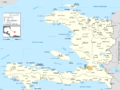 Haiti administrative map-fr.png 1,739 × 1,299; 606 KB
-
 Haiti administrative map-fr.svg 1,739 × 1,299; 490 KB
-
 Haiti blank map with departements.svg 1,739 × 1,299; 270 KB
-
 Haiti blank map with topography.png 1,739 × 1,299; 1.86 MB
-
 Haiti blank map with topography.svg 1,739 × 1,299; 4.91 MB
-
 Haiti blank map.svg 1,739 × 1,299; 257 KB
-
 Haiti departements map-fr.png 1,739 × 1,299; 411 KB
-
 Haiti departements map-fr.svg 1,739 × 1,299; 335 KB
-
 Haiti road map-fr.png 1,739 × 1,299; 1.87 MB
-
 Haiti road map-fr.svg 1,739 × 1,299; 3.74 MB
-
 Haiti topographic map-fr.png 1,739 × 1,299; 2.21 MB
-
 Haiti topographic map-fr.svg 1,739 × 1,299; 5.18 MB
-
 Kerguelen administrative map-fr.png 1,840 × 1,915; 907 KB
-
 Kerguelen administrative map-fr.svg 1,840 × 1,915; 939 KB
-
 Kerguelen blank map.svg 1,840 × 1,915; 751 KB
-
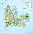
 Kerguelen topographic blank map.png 1,840 × 1,915; 1.65 MB
-
 Kerguelen topographic blank map.svg 1,840 × 1,915; 2.11 MB
-
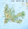 Kerguelen topographic map-fr.png 1,840 × 1,915; 2.08 MB
-
 Kerguelen topographic map-fr.svg 1,840 × 1,915; 2.33 MB
-
 Mayotte administrative map-fr.png 1,033 × 1,297; 373 KB
-
 Mayotte administrative map-fr.svg 1,033 × 1,297; 482 KB
-
 Mayotte blank map.svg 1,033 × 1,297; 343 KB
-
 Mayotte communes map-fr.png 1,033 × 1,297; 206 KB
-
 Mayotte communes map-fr.svg 1,033 × 1,297; 358 KB
-
 Mayotte road map-fr.png 1,033 × 1,297; 578 KB
-
 Mayotte road map-fr.svg 1,033 × 1,297; 738 KB
-
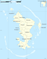
 Mayotte topographic blank map.png 1,033 × 1,297; 428 KB
-
 Mayotte topographic blank map.svg 1,033 × 1,297; 751 KB
-
 Mayotte topographic map-de.svg 1,033 × 1,297; 852 KB
-
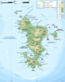 Mayotte topographic map-fr.png 1,033 × 1,297; 625 KB
-
 Mayotte topographic map-fr.svg 1,033 × 1,297; 874 KB


