Category:Maps of the Atlantic Ocean
Jump to navigation
Jump to search

Subcategories
This category has the following 39 subcategories, out of 39 total.
!
*
- Global maps centered 20W (4 F)
- Global maps centered 40W (1 F)
+
B
C
G
I
- Iroise sea maps (15 F)
L
M
- Maps of Atlantic hurricane seasons (1 P, 164 F)
- Maps of the Bermuda Triangle (33 F)
- Maps of the Bight of Benin (15 F)
- Maps of the triangular trade (23 F)
S
- Storegga maps (5 F)
W
Media in category "Maps of the Atlantic Ocean"
The following 158 files are in this category, out of 158 total.
-
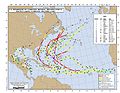
 2010atl.jpg 1,320 × 1,020; 865 KB
-
 2011atl.jpg 3,300 × 2,550; 3.24 MB
-
 80-188-CG Match Book Cover.jpg 640 × 480; 93 KB
-
_(14591120918).jpg/71px-A_short_history_of_England_(1904)_(14591120918).jpg) A short history of England (1904) (14591120918).jpg 1,420 × 2,378; 317 KB
A short history of England (1904) (14591120918).jpg 1,420 × 2,378; 317 KB
-
 Aabwpathways.svg 3,509 × 2,480; 2.05 MB
-
 Aabwvemaromanche-qgis.svg 1,052 × 744; 2.68 MB
-
 Abacela relative to Spain.png 342 × 170; 38 KB
-
_and_the_Azores_(Açôres)%2C_Published_1946.jpg/113px-Admiralty_Chart_No_1_Portsmouth_to_Canary_Islands_(Islas_Canarias)_and_the_Azores_(Açôres)%2C_Published_1946.jpg)
-
 Admiralty Chart No 367 Cape Verde to Ceara, Published 1928.jpg 12,242 × 8,291; 12.86 MB
-
 Agulhas Bank NOAA ETOPO1.jpg 703 × 417; 91 KB
-
 Agulhas Bank NOAA.jpg 1,010 × 682; 88 KB
-
 Agulhas Basin NOAA.jpg 730 × 617; 82 KB
-
 Analytische Plankton-Studien BHL10785925.jpg 2,022 × 2,617; 483 KB
-
_(18143068376).jpg/93px-Analytische_Plankton-Studien._Ziele%2C_Methoden_und_Anfangs-Resultate_der_quantitativ-analytischen_Planktonforschung_(1892)_(18143068376).jpg)
-
 Angola-DRC boundary. LOC 84692090.jpg 5,721 × 4,136; 2.34 MB
-
 Anti-Submarine Warfare Plotting Chart -8, 4th Edition - NARA - 6104968.jpg 3,150 × 3,129; 4.88 MB
-
 Antilles Current, NOAA.jpg 2,568 × 1,766; 1.7 MB
-
 Aquarius Sea Surface Salinity.jpg 4,320 × 3,240; 3.24 MB
-
 Atlantic current.jpg 190 × 275; 30 KB
-
_(W3)_(CWF).svg/120px-Atlantic_Ocean_in_the_world_(blue)_(W3)_(CWF).svg.png) Atlantic Ocean in the world (blue) (W3) (CWF).svg 3,936 × 2,405; 4.76 MB
Atlantic Ocean in the world (blue) (W3) (CWF).svg 3,936 × 2,405; 4.76 MB
-
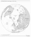
 Atlantic Ocean laea location map.svg 709 × 865; 274 KB
-
 Atlantic Ocean location map.svg 714 × 842; 234 KB
-
 Atlantic Ocean oc.png 328 × 328; 12 KB
-
 Atlantic Ocean surface.jpg 982 × 958; 249 KB
-
 Atlantic Oceanic-Crust.jpg 600 × 600; 301 KB
-
 Atlantin osat.png 633 × 636; 234 KB
-
 Atlantismeteorcomplex3d.png 1,020 × 609; 367 KB
-
 Azorestriple3d.png 1,020 × 609; 369 KB
-
 Açores, Madeira, Canarias.png 2,452 × 1,400; 1.13 MB
-
 BasenyAtlantyku.svg 751 × 824; 39 KB
-
 Bengal-study area hg.png 980 × 638; 436 KB
-
 Bouvettriplejunction3d.png 1,020 × 609; 470 KB
-
 Bouvettriplenarrow3d.svg 1,020 × 609; 505 KB
-
 Brockhaus14Konv-Atlantic Ocean.jpg 2,600 × 3,457; 2.58 MB
-
 Calcubo Ash 04-26-2015.jpg 1,000 × 700; 653 KB
-
 CarteBarme-Brest-Monaco-12mai14-RS.jpg 718 × 550; 122 KB
-
 Charlie-gibbs-full-extent.png 1,020 × 626; 310 KB
-
 Charliegibbstransform.png 1,020 × 609; 303 KB
-
 Charliegibbstransform.svg 1,020 × 609; 424 KB
-
 Chart1.jpg 700 × 480; 81 KB
-
 Cold seeps of the Atlantic Ocean.png 2,028 × 939; 1.02 MB
-
 Continuous Track Ivan.png 1,024 × 633; 373 KB
-
 Corriente de james Rennell.png 357 × 240; 150 KB
-

-

-
 Drake passage en.png 928 × 846; 237 KB
-
 Drake passage.png 930 × 847; 239 KB
-
 Earth from Space. A gush of volcanic gas, 06-06-2011.png 385 × 406; 173 KB
-
 East Scotia Ridge - Plos Biol 02.tif 2,894 × 3,439; 9.26 MB
-
 EB1911 Plankton - Atlantic surface currents.jpg 778 × 953; 346 KB
-
 EB1911 Plankton - Atlantic surface isotherms.jpg 773 × 1,122; 363 KB
-
_(14771615442).jpg/88px-Elementary_physical_geography_(1907)_(14771615442).jpg) Elementary physical geography (1907) (14771615442).jpg 1,456 × 1,988; 753 KB
Elementary physical geography (1907) (14771615442).jpg 1,456 × 1,988; 753 KB
-
 Faroe12.PNG 1,154 × 856; 102 KB
-
 First of June 1794 Map.png 431 × 522; 12 KB
-
 FMIB 35208 Position Where the Tile Fish Were First Taken.jpeg 668 × 1,129; 161 KB
-
-
 FMIB 36547 Les Grandes Pecheries de Morue de l'Ocean Atlantique.jpeg 1,489 × 1,024; 195 KB
-

-

-
 FMIB 36589 French Shore de Terre-Neuve depuis 1783.jpeg 1,477 × 994; 196 KB
-
 FMIB 36592 Pecheries Francaises apres le Traite d'Utrecht, 1713.jpeg 1,390 × 921; 192 KB
-
 FMIB 36700 Fragment d'une Carte des Vents, a l'usage des navigateurs.jpeg 1,227 × 947; 205 KB
-

-
-
 FMIB 42084 Map shoing territory covered by the Anglo-Denmark Convention of 1901.jpeg 1,436 × 1,081; 149 KB
-

-
 FMIB 43860 Course of the Icebergs Between Europe and America.jpeg 873 × 783; 241 KB
-

-
 FMIB 49363 Track of the HMS "Lightning" -- 1868.jpeg 1,888 × 1,480; 627 KB
-
 FMIB 49364 First Cruise of H M S "Porcupine" -- 1869.jpeg 1,446 × 1,893; 616 KB
-
 FMIB 49365 Second Cruise of H M S "Porcupine" -- 1869.jpeg 1,864 × 1,400; 912 KB
-
 FMIB 49366 Third Cruise of HMS "Porcupine" -- 1869.jpeg 1,872 × 1,448; 1.02 MB
-

-
 Free-Air gravity anomaly map around Britain and Ireland.png 505 × 589; 341 KB
-
 G-I-UK-Lücke.png 590 × 346; 48 KB
-
 GIUK gap.png 1,024 × 1,239; 769 KB
-
 GMRTv3 1 20160102.jpg 673 × 553; 61 KB
-
 Golf van Guinee.jpg 891 × 557; 78 KB
-
 Golfstrom Karte 2.png 649 × 544; 143 KB
-
 GRAN SOLE.png 655 × 818; 18 KB
-
 GrandBanks23.jpg 300 × 200; 10 KB
-
 Greatmeteorseamount3d.svg 1,020 × 609; 500 KB
-
 Guik gap.gif 1,024 × 1,239; 465 KB
-
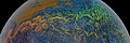 Gulf Stream Sea Surface Currents and Temperatures NASA SVS.jpg 6,840 × 2,304; 4.41 MB
-
 Halley compass variations 1702.jpg 642 × 800; 150 KB
-
 Halley compass variations 1720.jpg 1,000 × 1,260; 319 KB
-
 Hebrides and The Minch.svg 1,060 × 1,900; 903 KB
-
 Koordinates-0W,0S.jpg 992 × 654; 72 KB
-
 Location of Fram Strait with surrounding geographical places.jpg 1,196 × 1,007; 276 KB
-
 LocationAtlanticOcean.png 2,760 × 1,398; 281 KB
-

-
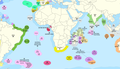 Map of the Territorial Waters of the Atlantic and Indian Ocean.png 2,919 × 1,676; 588 KB
-
-
%2C_Acervo_do_Museu_Paulista_da_USP.jpg/90px-Mapa_da_Comissão_Geográfica_e_Geológica_do_Estado_de_São_Paulo_-_Folha_de_Barra_de_Santos_-_1_(1)%2C_Acervo_do_Museu_Paulista_da_USP.jpg)
-
%2C_Acervo_do_Museu_Paulista_da_USP.jpg/90px-Mapa_da_Comissão_Geográfica_e_Geológica_do_Estado_de_São_Paulo_-_Folha_de_Barra_de_Santos_-_1_(2)%2C_Acervo_do_Museu_Paulista_da_USP.jpg)
-
 Mapa Ptolomeo Detalle Atlantico.jpg 1,200 × 1,600; 648 KB
-
 Mappa an Mor Keltek.png 431 × 719; 24 KB
-
 Maury plate 04.jpg 676 × 981; 760 KB
-
 MeanWaveHeight1992.png 402 × 257; 97 KB
-
 Mediterranean Area Map.jpg 557 × 419; 64 KB
-
 Mid northern atlantik.PNG 1,855 × 932; 313 KB
-
 Mid-atlantic ridge.jpg 1,000 × 1,690; 974 KB
-
 MygifCurrent.gif 1,352 × 664; 23.51 MB
-
 NAM-SAM-AFR-triple junction.jpg 800 × 800; 209 KB
-
.jpg/120px-NASA%27s_Aquarius_Sees_Salty_Shifts_(8512914685).jpg) NASA's Aquarius Sees Salty Shifts (8512914685).jpg 5,760 × 3,240; 1.69 MB
NASA's Aquarius Sees Salty Shifts (8512914685).jpg 5,760 × 3,240; 1.69 MB
-
_(8512918417).jpg/120px-NASA%27s_Aquarius_Sees_Salty_Shifts_(hd_video)_(8512918417).jpg) NASA's Aquarius Sees Salty Shifts (hd video) (8512918417).jpg 1,280 × 720; 215 KB
NASA's Aquarius Sees Salty Shifts (hd video) (8512918417).jpg 1,280 × 720; 215 KB
-
 NATO Atlantic and Channel commands subareas.png 2,499 × 1,432; 257 KB
-
-
 Nautical chart of RMS Carpathia, 1912.04.15.png 1,026 × 684; 859 KB
-
 NE seamounts.jpg 600 × 572; 71 KB
-
 North Atlantic 128 years.jpg 4,212 × 1,968; 1.14 MB
-
 North Atlantic Basin blank low.JPG 962 × 648; 39 KB
-
 North Atlantic Ocean laea location map.svg 709 × 575; 290 KB
-
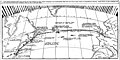
 North Atlantic Plot April 1944.jpg 602 × 434; 103 KB
-
 Ocean currents 1943 Gulf Stream.png 1,101 × 650; 1.08 MB
-
 Ocean dumping of radioactive waste in Atlantic Ocean.png 1,280 × 720; 2.27 MB
-
 Orthographic projection above St Helena.png 488 × 487; 9 KB
-
 Orthographic projection centered over Bouvet Island.png 488 × 487; 35 KB
-
 Orthographic projection centred on the South Sandwich Islands.png 488 × 487; 17 KB
-
 Orthographic projection centred over Fernando de Noronha.png 488 × 487; 19 KB
-
 Orthographic projection centred over South Georgia Island.png 488 × 487; 17 KB
-
 Orthographic projection centred over St Peter and St Paul Rocks.png 488 × 487; 19 KB
-
 Orthographic projection centred over the Azores.png 488 × 487; 21 KB
-
 Orthographic projection over Gough Island.png 488 × 487; 20 KB
-

-
 OSPAR Commission area map.svg 740 × 800; 202 KB
-
 PAT - Atlantic Ocean.gif 1,575 × 2,050; 450 KB
-
 Portion of the New England hotspot.png 514 × 453; 17 KB
-
 Portuguese Search and Rescue Area.gif 1,144 × 1,550; 41 KB
-
 Potential Scope of TU-95 Surveillance Coverage of Atlantic Ocean.png 811 × 1,112; 118 KB
-
 Primary production B-M Confluence Zone.gif 526 × 396; 39 KB
-
 Proposed wind farm leases in the New York Bight, 2021 BOEM.png 1,374 × 1,054; 388 KB
-
 Rio Grande Rise NOAA.jpeg 569 × 474; 39 KB
-
 Route der Plankton-Expedition von 1889.png 1,821 × 1,729; 1.37 MB
-
_(14581063568).jpg/81px-Sadlier%27s_excelsior_studies_in_the_history_of_the_United_States%2C_for_schools_(1907)_(14581063568).jpg)
-
 Scotiazee en scotiarug.png 1,280 × 747; 624 KB
-
 SeaHebrides TheMinch map-fr.svg 1,060 × 1,900; 914 KB
-
 Seewarte3d.svg 1,020 × 609; 513 KB
-
 SMOS2010.png 1,418 × 598; 1,009 KB
-
_(14778542762).jpg/75px-South_America%3B_a_popular_illustrated_history_of_the_struggle_for_liberty_in_the_Andean_republics_and_Cuba_(1898)_(14778542762).jpg)
-
 South Atlantic Ocean laea location map.svg 710 × 704; 93 KB
-

-
_(14576576708).jpg/55px-The_gate_of_the_Pacific_(1863)_(14576576708).jpg) The gate of the Pacific (1863) (14576576708).jpg 1,944 × 4,240; 879 KB
The gate of the Pacific (1863) (14576576708).jpg 1,944 × 4,240; 879 KB
-
.jpg/120px-thumbnail.jpg)
-
.jpg/120px-The_Virginia_Company_chart_(NYPL_Hades-118534-54658).jpg) The Virginia Company chart (NYPL Hades-118534-54658).jpg 4,938 × 2,854; 16.16 MB
The Virginia Company chart (NYPL Hades-118534-54658).jpg 4,938 × 2,854; 16.16 MB
-
 Trajectoire du caudan.png 463 × 560; 190 KB
-
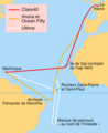 Transat Jacques-Vabre 2021 parcours.png 1,870 × 2,295; 185 KB
-
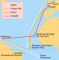 Transat Jacques-Vabre 2023 parcours initial.png 1,638 × 1,656; 158 KB
-
 Transat Jacques-Vabre 2023 parcours.png 1,634 × 1,654; 192 KB
-
 Tropical waves.jpg 2,374 × 944; 149 KB
-
 Vemafracturezone-qgis.svg 1,052 × 744; 2.34 MB
-
 Vematransform.png 1,020 × 609; 282 KB
-
 Viajes de Colón y exploraciones simultáneas, 1492-1504.jpg 1,388 × 1,135; 331 KB
-
 Western Atlantic Defense Zone.jpg 1,731 × 2,521; 628 KB
-
 WGSRPD Middle Atlantic Ocean.png 330 × 299; 16 KB
-
 Wind energy leases offshore Massachusetts and Rhode Island, 2022.png 2,550 × 3,300; 2.59 MB
-
 Wind farm leases in the New York Bight, 2022 - BOEM.png 1,024 × 741; 589 KB
-
 Zona de Fractura Shackleton.png 397 × 582; 238 KB


_(14591120918).jpg)


_and_the_Azores_(Açôres),_Published_1946.jpg)


_(18143068376).jpg)


_(W3)_(CWF).svg)


_(14771615442).jpg)


,_Acervo_do_Museu_Paulista_da_USP.jpg)
,_Acervo_do_Museu_Paulista_da_USP.jpg)


.jpg)
_(8512918417).jpg)


_(14581063568).jpg)


_(14778542762).jpg)

_(14576576708).jpg)
.jpg)
.jpg)


